A Deep Dive Into the Lower Mississippi River
Much of the Mississippi between Natchez and Venice, LA is below the surface of the Gulf of Mexico. A large portion of the river from Donaldsonville to Venice is below the BOTTOM of the entrance leading to the Gulf of Mexico (GoM). Chart 1 shows the elevations of the Gulf surface and the bottom in the reach of Venice to Heads of Passes where the Mississippi River (MSR) begins to merge into the Gulf.
The River’s surface elevations are taken from locations’ annual average gauge readings for 2017 which are higher than the past 70 years’ average, but normal for the 1990 to 2019 period. More detail is available in Table 1 at the end of BPF’s article – “The River Stands Still”.
Table 1
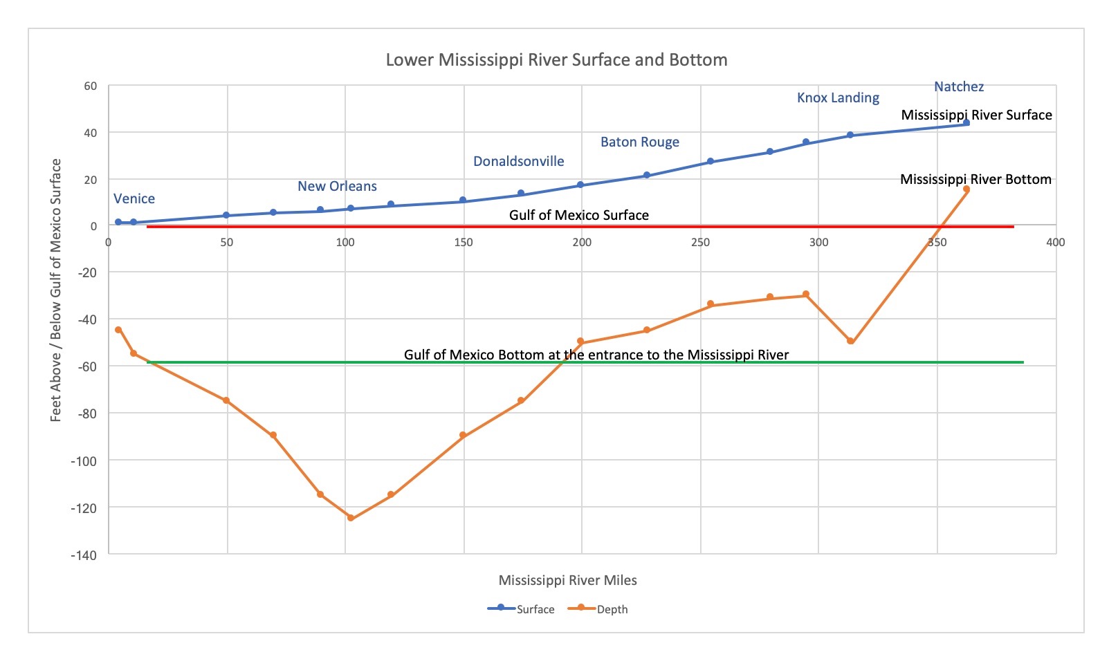
The line depicting the MSR bottom approximates the average depth of significant portions of the river at each location. If a location has only a small deep portion but the majority of the region was 30 ft. higher, the higher average was used. The depths shown for about 50 river miles around New Orleans greatly understate the actual depth of the MSR bottom, which is -200 ft. in some places.
Note the bump in the river bottom below Natchez around mile 300. The bump begins just below Old River Control Station (ORCS) where 23% of the MSR waters are diverted to the Atchafalaya River Basin. This results in slower MRS flow just below ORCS and greatly increased sedimentation. A massive 20 to 25-mile long sand plug has developed. (See BPF’s article with video: Dr. Y. Jun Xu’s “Not a Matter of If, But a Matter of When” MSR in Danger of Being Captured by the Atchafalaya River.) From ORCS to the sharp river bend rounding at Donaldsonville – mile 175, the river has many sharp hairpin bends which slow the flow and create areas of sedimentation or alluviums. The Baton Rouge to Donaldsonville stretch of the MSR is one of active dredging by the Corps. to maintain the channel for Baton Rouge deep water shipping.
South of Donaldsonville, the river is deep, wide and relatively straight to New Orleans where the famous crescent bend gives the city police an emblem. Past the crescent, the river again has a fairly straight and slightly less deep path almost to Venice. From Donaldsonville, almost all the waters are below the Mean Low Gulf surface and a large portion of the waters are below the BOTTOM of the last river stretch where it merges with the Gulf.
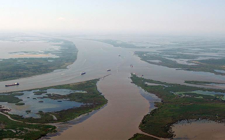
On the chart, scan past the deep river waters below New Orleans and note the rise in the bottom at Venice – mile 11. The “hump” which begins on our Chart extends for 11 miles to the Head of Passes and from there many more miles in all directions until the deeper waters of the Gulf are reached. The bottom along the 29-mile long South West Pass, the main shipping exit from the MSR to the deeper Gulf, is surrounded by water that is only 15, 20 sometimes 30 ft. deep. Dredging helps maintain the South West Pass through what was once evolving wetlands.
But the wetlands have been receding, not expanding as one would expect of a great alluvial river delta. So, where is the sediment which was once depositing to form Louisiana’s marshes and wetlands? A tiny portion of dredge tailings are pumped out of the levees, but most of the sediment stays within the levees. The river is filling up. Floods occur south to north (see BPF’s article “The Mississippi River Is Backing Up”), even if most of the water fell upriver. From Natchez to Baton Rouge, with ORCS as the focus point, heavy flows back up the river waters to Vicksburg and Greenville. Sediment is building far north from ORCS. That bump below ORCS is a beast.
A simplified picture is one of the MSR surmounting a huge hump in the bottom below Natchez, only by backing up and building head or elevation to do so. Once past the underwater hill, the waters encounter switchback after switchback curves in the River, sapping energy and depositing more sedimentation. From Donaldsonville, the path is relatively straight and deep, but much of the water is carried below the bottom of the Gulf from Donaldsonville out to the exit path below Venice. Water does not flow uphill readily. It takes a huge external source of energy to carry water from a lower elevation to a higher one. Tidal action and turbulence within the MSR waters, along with temperature gradient and other sources provide some energy. Much of the lower river, however, would prefer to just rest in place or go with the tide.
To sign up for MS River updates from BPF, subscribe here.
Another good article about the river, Mr. Grayson. Thanks!
Now we just need to figure out how to move that “bump” between miles 200 and 300 down to mile 100.